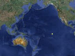
Every day we send out a position update that gives our current position in latitude and longitude, our course over ground (COG) and our speed over ground (SOG) in knots. But what does this all mean? And why knots and nautical miles instead of mph and miles?
First off, let's tackle latitude and longitude. You know the earth is divided up into a huge grid. Horizontally there is a slice in the middle, the equator. Then equally spaced both north and south are 90 slices each side, one degree of latitude each. The distance between each degree of latitude is equal, so if you move one degree at the equator and one degree near a pole you have gone the same distance.
Not so with longitude. The vertical lines of longitude converge at the poles, so a change of a degree at the equator is a vastly longer distance than the same change near a pole.
Now, each degree of latitude or longitude is subdivided into 60 minutes. Each minute of latitude, which is equal to any other, is one nautical mile. So, when we report that we are at 3deg 30.0S, it means we are 3*60=180 + 30.0, or 210 nautical miles south of the equator. Pretty simple, huh?
But if we are not traveling due north there is more to it. You have to take into account both the vertical (latitude) distance as well as the horizontal (longitude) distance.
Right now, since we are near the equator, one degree of latitude is the same distance as one degree of longitude, so the math is simple. Let's say we plan to cross at 147 degrees longitude. Since we are now at 148 degrees, that is just 60 nm away to the east. But we have to go the 210 nm north as well. The actual distance we will travel is SQRT(Lat*Lat+Lon*Lon). To do the math, it's 210*210+60*60=47700. The square root of this number is 218.4, which is the distance we have to go.
The same process is used to find the distance between any two points. For example, our last two reports showed our positions as:
8/30 06deg 02.9S, 148deg 21.3W
8/31 04deg 05.5S, 148deg 09.9W
The distance we traveled is (06*60+02.9)-(04*60+05.5)=117.4 (148*60+21.3)-(148*60+09.9)=11.4
117.4*117.4+11.4*11.4=13912.72 SQRT(13912.72)=117.95 So we traveled 117.95 nautical miles between these two reports.
Knots (in this context) are just nautical miles per hour.
Statute miles (like miles on your car) are almost the same length, but not quite. There are 1.1 statute miles for each nautical mile. So when the wind is blowing at 30 kts (nautical miles per hour), it is blowing 30*1.1 or 33 mph.
So that's it. That is why nautical miles make more sense at sea. Now you can calculate how far we have gone at each report, and how far we still have to go.


No comments:
Post a Comment