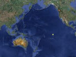
Just north of the equator is a band called the InterTropical Convergence Zone (ITCZ, or doldrums). This band runs pretty much from Central America to SE Asia, and is widest near Central America. This region has generally very light winds and frequent squalls, some of them violent. Some of these squalls will grow to become North Pacific hurricanes, but in the ITCZ they are just forming and are still relatively weak. Sailors always dread the doldrums, as did we, but in our two crossings in the past six months we had pretty benign conditions.
Just north and south of the ITCZ are the two tradewind zones. These are characterized by good steady winds, both sides trending westward. In the north the trades blow from the northeast, in the south from the southeast. The trades extend out to about 15-20 degrees latitude each side. They also have some squalls, but these squalls are fast moving and not usually violent. These storms also never pass through the ITCZ - in fact, no storms form in one hemisphere and travel to the other. The ITCZ is a barrier that effectively separates the two.
Outside the trade wind zones is a lot of ocean. The primary feature of both the North and South Pacific Oceans is a permanent high pressure region. High pressure regions are known for light winds and sunny skies, while low pressure cells are associated with storms. While this is generally true, it is the association between the lows and highs that most affects us. Remember that wind is created by these pressure gradients, and the steeper the gradient (i.e. the larger the difference in high and low pressure regions, or the closer they are to each other) the stronger the wind. The trick is knowing exactly where they are so we can predict how strong the winds will be so as to avoid really strong and really light wind areas.
While the two high pressure regions of interest here are permanent, they are definitely not stationary, nor are they of consistent size or shape. You have to track them and try to predict, based on past observation and outside influences, where they will be at some future time. This is where the WeatherGuy comes in. He analyzes the big picture all day, every day, and tries to predict our best route.
Remember that winds swirl clockwise around a high, and counter-clockwise around a low. This means that, to get winds that will most help us get to Seattle, we need to pass west of the high, and then follow the winds around eastward across the top. This is the game we are playing right now - guess the future position and size of the high so we can benefit from it, and not be stuck in really light or really strong winds.


No comments:
Post a Comment